Geospatial Information and Technology
Filter by
SubjectRequired
LanguageRequired
The language used throughout the course, in both instruction and assessments.
Learning ProductRequired
LevelRequired
DurationRequired
SubtitlesRequired
EducatorRequired
Results for "geospatial information and technology"
 Status: Preview
Coursera Instructor Network
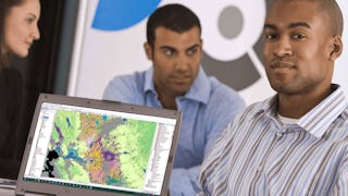
Skills you'll gain: Geographic Information Systems, Geospatial Information and Technology, Geospatial Mapping, Spatial Data Analysis, Spatial Analysis, Global Positioning Systems, Data Analysis
 Status: Free Trial
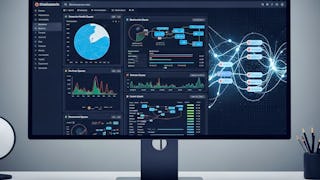
Skills you'll gain: Power BI, Data Ethics, Data Visualization Software, Data Analysis, Statistical Analysis, Correlation Analysis, Business Intelligence, Advanced Analytics, Data Analysis Expressions (DAX), Analytics, Data-Driven Decision-Making, Exploratory Data Analysis, Trend Analysis, Time Series Analysis and Forecasting, Scatter Plots, Forecasting, Geospatial Information and Technology, Root Cause Analysis
 Status: Preview
UNSW Sydney (The University of New South Wales)
Skills you'll gain: Image Analysis, Unsupervised Learning, Geospatial Information and Technology, Computer Vision, Spatial Analysis, Machine Learning, Dimensionality Reduction, Linear Algebra, Deep Learning, Data Validation, Supervised Learning, Probability & Statistics, Artificial Neural Networks
 Status: NewStatus: Free Trial
Skills you'll gain: Photography, Geospatial Information and Technology, Geospatial Mapping, Geographic Information Systems, Global Positioning Systems, Planning, Research, Creative Thinking, Critical Thinking, Data Import/Export
 Status: Free Trial
University of California, Davis
Skills you'll gain: ArcGIS, Geographic Information Systems, Public Health and Disease Prevention, Public Health, Land Management, Geospatial Information and Technology, Geospatial Mapping, Spatial Analysis, Epidemiology, Community Health, Spatial Data Analysis, Social Determinants Of Health, Emergency Response, Environmental Science, Natural Resource Management, Emergency Services, Business Development, Environment and Resource Management, Hazard Analysis, 3D Modeling
 Status: NewStatus: Free Trial
Skills you'll gain: Real Time Data, Kibana, Query Languages, Data Modeling, Distributed Computing, SQL, NoSQL, Application Programming Interface (API), Scalability, JSON, Performance Tuning, System Configuration, Geospatial Information and Technology
 Status: Free Trial
DeepLearning.AI
Skills you'll gain: Disaster Recovery, Image Analysis, Data Ethics, Emergency Response, Mitigation, Text Mining, Natural Language Processing, Artificial Intelligence, Computer Vision, Geospatial Information and Technology, Machine Learning Methods, Data Analysis
 Status: Preview
École Polytechnique Fédérale de Lausanne
Skills you'll gain: Geospatial Mapping, Geographic Information Systems, Geospatial Information and Technology, Spatial Data Analysis, Spatial Analysis, Global Positioning Systems, 3D Modeling, Visualization (Computer Graphics), Survey Creation, Systems Of Measurement
 Status: Free Trial
Skills you'll gain: Computer Vision, Image Analysis, Deep Learning, Matlab, Applied Machine Learning, Machine Learning, Motion Graphics, Supervised Learning, Predictive Modeling, Artificial Intelligence and Machine Learning (AI/ML), Visualization (Computer Graphics), Geospatial Information and Technology, Data Integration, Medical Imaging, Data Validation, Estimation, Machine Learning Methods, Performance Tuning, Algorithms
 Status: Preview
Duke University
Skills you'll gain: Environmental Monitoring, Environmental Regulations, Environmental Laws, Environmental Science, Geospatial Information and Technology, Ethical Standards And Conduct, Global Positioning Systems, Research, Data Management, Critical Thinking
 Status: Free Trial
Skills you'll gain: Keras (Neural Network Library), Deep Learning, PyTorch (Machine Learning Library), Machine Learning Methods, Computer Vision, Geospatial Information and Technology, Machine Learning, Data Pipelines, Artificial Intelligence, Python Programming
 Status: Free Trial
University of Colorado Boulder
Skills you'll gain: Global Positioning Systems, Journalism, Environmental Monitoring, Music, Geospatial Information and Technology, Political Sciences, Entrepreneurship, Systems Engineering, Concept Of Operations, Culture, Media and Communications, Governance, Higher Education, Public Policies, Physical Science, Liberal Arts, Geographic Information Systems, Art History, Engineering Design Process, Writing