Filter by
SubjectRequired
LanguageRequired
The language used throughout the course, in both instruction and assessments.
Learning ProductRequired
LevelRequired
DurationRequired
SkillsRequired
SubtitlesRequired
EducatorRequired
Results for "geospatial mapping"
 Status: NewStatus: Free Trial
Skills you'll gain: 3D Assets, 3D Modeling, Unreal Engine, Video Game Development, Computer Graphics
 Status: Free
École normale supérieure
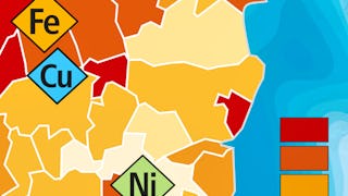
Skills you'll gain: Infographics, Geospatial Mapping, Data Mapping, Geographic Information Systems, Graphic and Visual Design, Graphics Software, World History, Color Theory
 Status: Preview
The University of Edinburgh
Skills you'll gain: Environmental Monitoring, Geospatial Information and Technology, Environment, Global Positioning Systems, Geographic Information Systems, Spatial Data Analysis, Climate Change Programs, Image Analysis, Continuous Monitoring, Forecasting, Data Collection
 Status: Free TrialStatus: AI skills
Skills you'll gain: Software Development Life Cycle, Open Web Application Security Project (OWASP), Istio, Linux Commands, Software Architecture, Application Deployment, Kubernetes, NoSQL, Bash (Scripting Language), MongoDB, Restful API, Shell Script, Django (Web Framework), Object-Relational Mapping, OpenShift, Git (Version Control System), Grafana, Microservices, Data Import/Export, Python Programming
 Status: NewStatus: Free Trial
University of Colorado Boulder
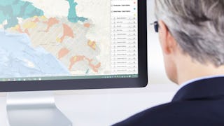
Skills you'll gain: Data Visualization Software, Tableau Software, Data Visualization, Data Analysis, Geospatial Mapping, Data Storytelling, Business Analytics, Data Presentation, Advanced Analytics, Spatial Analysis, Marketing Analytics, Data Science, Data Manipulation, Forecasting
 Status: Free Trial
University of California, Davis
Skills you'll gain: Spatial Analysis, ArcGIS, Geographic Information Systems, Geospatial Mapping, Data Quality, Data Mapping, Data Modeling, Data Management, Data Storage, Data Sharing, Data Manipulation, Relational Databases, Query Languages, Analytics
 Status: NewStatus: Preview
Skills you'll gain: Data Storytelling, Interactive Data Visualization, Data Presentation, Data Visualization Software, Scatter Plots, Infographics, Storytelling, Geospatial Mapping, Box Plots, Histogram, Data Ethics, Design Elements And Principles
 Status: Preview
The Pennsylvania State University
Skills you'll gain: Geographic Information Systems, Case Studies, Climate Change Programs, Systems Thinking, Design Thinking, Geospatial Information and Technology, Sustainable Design, Spatial Analysis, Collaborative Software, Decision Support Systems, Cultural Responsiveness
 Status: Preview
École Polytechnique Fédérale de Lausanne
Skills you'll gain: Spatial Analysis, Geographic Information Systems, Geospatial Mapping, Spatial Data Analysis, Augmented Reality, Data Visualization Software, Data Mapping, Color Theory, Database Management
 Status: Free Trial
Universidad de los Andes
Skills you'll gain: Spatial Analysis, NoSQL, Spatial Data Analysis, Geospatial Mapping, Geographic Information Systems, Public Cloud, Big Data, MongoDB, Apache Hadoop, Apache Spark, Distributed Computing, Data Architecture, Cloud Services, Data Processing, Database Systems, Cloud Computing, Scalability, Databases, Environmental Monitoring, Climate Change Programs
 Status: Free Trial
University of California, Davis
Skills you'll gain: ArcGIS, Geographic Information Systems, Public Health and Disease Prevention, Public Health, Land Management, Geospatial Information and Technology, Geospatial Mapping, Spatial Analysis, Epidemiology, Community Health, Spatial Data Analysis, Social Determinants Of Health, Emergency Response, Environmental Science, Natural Resource Management, Emergency Services, Business Development, Environment and Resource Management, Hazard Analysis, 3D Modeling
 Status: Free Trial
University of Michigan
Skills you'll gain: Sustainable Development, Geographic Information Systems, Geospatial Mapping, Sustainability Reporting, Spatial Data Analysis, Sustainable Business, Spatial Analysis, Data Storytelling, Environmental Monitoring, Data Visualization, Stakeholder Engagement, Trend Analysis, Decision Making
In summary, here are 10 of our most popular geospatial mapping courses
- Blender Modeling & Export: From Props to Unreal: EDUCBA
- Cartographie thématique: École normale supérieure
- Observing Earth From Space: The University of Edinburgh
- IBM Back-End Development: IBM
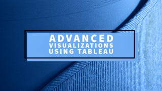
- Advanced Visualizations using Tableau: University of Colorado Boulder
- GIS Data Formats, Design and Quality: University of California, Davis
- Data Visualization and the Art of Storytelling - Bachelor's: Illinois Tech
- Geodesign: Change Your World: The Pennsylvania State University
- Systèmes d’Information Géographique - Partie 2: École Polytechnique Fédérale de Lausanne
- Plataformas para procesar datos no tradicionales: Universidad de los Andes


