Filter by
SubjectRequired
LanguageRequired
The language used throughout the course, in both instruction and assessments.
Learning ProductRequired
LevelRequired
DurationRequired
SkillsRequired
SubtitlesRequired
EducatorRequired
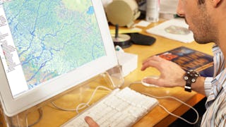
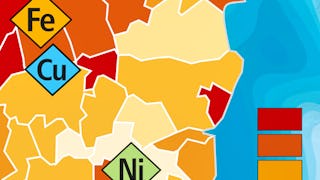
Explore the Cartography Course Catalog
 Status: Free Trial
University of California, Davis
Skills you'll gain: ArcGIS, GIS Software, Spatial Analysis, Data Storytelling, Spatial Data Analysis, Geographic Information Systems, Data Presentation, Geospatial Mapping, Public Health and Disease Prevention, Public Health, Land Management, Geospatial Information and Technology, Heat Maps, Data Sharing, Epidemiology, Community Health, Metadata Management, Image Analysis, Project Management, Global Positioning Systems
 Status: Free Trial
University of Toronto
Skills you'll gain: ArcGIS, Spatial Data Analysis, Spatial Analysis, Geographic Information Systems, Geospatial Mapping, GIS Software, Data Mapping, Geospatial Information and Technology, Data Visualization, Metadata Management, Query Languages, Global Positioning Systems, Quantitative Research, Data Compilation, Typography, Data Manipulation, Data Storytelling, Data Modeling, Design Elements And Principles, Image Analysis
 Status: Free Trial
University of California, Davis
Skills you'll gain: ArcGIS, GIS Software, Geographic Information Systems, Spatial Analysis, Data Sharing, Geospatial Mapping, Metadata Management, Data Analysis, Data Mapping, Data Quality, Data Visualization, File Management
 Status: Preview
Universitat de Barcelona
Skills you'll gain: Global Positioning Systems, Physical Science, Water Resources, Water Quality, Geographic Information Systems, Geospatial Information and Technology, Chemistry, Environment, Environmental Science, Mechanics, Biology, Systems Of Measurement, Climate Change Mitigation, Remote Access Systems
 Status: Free Trial
University of Toronto
Skills you'll gain: ArcGIS, Spatial Data Analysis, Geographic Information Systems, Spatial Analysis, Geospatial Mapping, Data Mapping, Global Positioning Systems, Data Capture
 Status: Free
École normale supérieure
Skills you'll gain: Infographics, Geospatial Mapping, Data Mapping, Geographic Information Systems, Graphic and Visual Design, Graphics Software, World History, Color Theory
What brings you to Coursera today?
 Status: Free Trial
University of Toronto
Skills you'll gain: Geographic Information Systems, Geospatial Mapping, Data Mapping, Spatial Data Analysis, Data Visualization, Metadata Management, Quantitative Research, Spatial Analysis, Typography, Data Manipulation, Data Modeling, Design Elements And Principles
 Status: Preview
École Polytechnique Fédérale de Lausanne
Skills you'll gain: Geographic Information Systems, GIS Software, Spatial Data Analysis, NoSQL, Data Modeling, Database Design, Databases, Data Storage Technologies, SQL, Data Storage, Data Capture, Query Languages, Relational Databases
 Status: Free Trial
University of Toronto
Skills you'll gain: Geographic Information Systems, GIS Software, Spatial Analysis, Spatial Data Analysis, Geospatial Information and Technology, Geospatial Mapping, Query Languages, Data Manipulation, Image Analysis
 Status: Preview
Michigan State University
Skills you'll gain: Infographics, Adobe Illustrator, Graphic and Visual Design, Data Mapping, Graphic Design, Typography, Design Elements And Principles, Graphical Tools, Storytelling, Color Theory
Coursera Project Network
Skills you'll gain: Data Visualization, Data Literacy, Data Presentation, Google Sheets, Data Compilation, Data Visualization Software, Graphing, Spreadsheet Software
 Status: Preview
Politecnico di Milano
Skills you'll gain: Ancient History, Architectural Design, Civil and Architectural Engineering, Social Studies, Architecture and Construction, World History, Physical Science, Cultural Diversity
In summary, here are 10 of our most popular cartography courses
- Geographic Information Systems (GIS): University of California, Davis
- GIS, Mapping, and Spatial Analysis: University of Toronto
- Fundamentals of GIS: University of California, Davis
- Oceanography: a key to better understand our world: Universitat de Barcelona
- Introduction to GIS Mapping: University of Toronto
- Cartographie thématique: École normale supérieure
- GIS Data Acquisition and Map Design: University of Toronto
- Geographical Information Systems - Part 1: École Polytechnique Fédérale de Lausanne
- Spatial Analysis and Satellite Imagery in a GIS: University of Toronto
- Design and Make Infographics (Project-Centered Course): Michigan State University


